
Geography
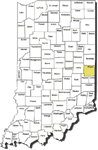 Wayne County is located in Indiana in the mid-western area of the United States of America, west of Ohio, south of Michigan, east of Illinois, and north of Kentucky.
With Wayne County's placement on the eastern edge of Indiana, it to shares its eastern border with Preble and Darke counties in Ohio. To the south is Fayette and Union counties, to the north is Randolph county and Henry county to the west.
County seat: Richmond
Elevation: 966
USGS 7.5' x 7.5'
Latitude: 394944N
Longitude: 0845325W
Location
County Feature Details
Watershed Information
Wayne County currently adheres to Eastern Time. Wayne County observes Eastern Daylight Time from March to November. Learn more about Time Zones in Indiana.
Wayne County contains the "highest point in Indiana" with an elevation of 1,257 feet above sea level The location is on private property near Bethel, Indiana.
Visit WayNet's MAP section for additional details.


Did You Know?
Follow Us
![]()
![]()
![]()
![]()
Contact Us
| Email: | info@waynet.org |
| Phone: | 765.939.0857 |
| Mail: | 50 North 5th St. Richmond, IN 47374 |
| Director: | Board of Directors |
Stay in Touch
Sign up for WayNet News
- our e-newsletter.