
The Biking / Hiking / Running / Driving Tour of Richmond's
National Register of Historic Districts
Prepared by the Richmond Columbian Properties, a non-profit historic preservation organization dedicated to the preservation of the William G. Scott House and the Historic Architecture of Richmond, Indiana.
Shared by WayNet with permission.
-
-
NOTE: both .pdfs require legal size paper to print properly.
-
Map created by Gunty Atkins, Wayne County Surveyor's Office
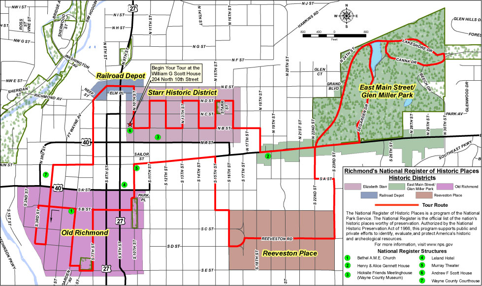
Click on map to view a full size version.
Map created in 2010.
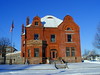
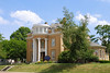
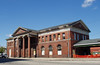
| Structures on the National Register of Historic Places | |
|
|
 Begin your tour at the William G. Scott House (formerly the Knights of Columbus), 204 North 10th Street.
Go east on North B Street to North 11th Street, then left to North D Street. Follow the other streets connecting with North B and D Streets. This will take you through the Starr Historic District. Go two blocks east on North B Street to North 18th Street and turn right.
 From North 18th Street, you will enter the East
Main Street Glen Miller Park Historic District, traveling east along Main Street to 22nd Street. It is recommended to stay on the sidewalk to avoid heavy traffic.
From North 18th Street, you will enter the East
Main Street Glen Miller Park Historic District, traveling east along Main Street to 22nd Street. It is recommended to stay on the sidewalk to avoid heavy traffic.
There is an optional 2 mile loop through Glen Miller Park. At 22nd Street, take North Drive around the north side of the lake, past the playground, which becomes Canna Drive. Turn right onto Middle Drive and continue on around the lake, back to Canna Drive to Lower Drive on the west side of the lake and continue on to Main Street. Turn right on Main Street, back to 22nd Street, to continue the tour.
On 22nd Street you enter the Reeveston Road Historic District. Turn left on South A Street to South 23rd Street. Go south on 23rd Street until you reach Reeveston Road. Turn right to go west on Reeveston Road to South 16th Street. At South 16th Street, turn left onto South B Street, continuing to South 15th Street.
At South 15th Street, turn right to continue north and back to Main Street. Turn left to head west on Main Street to 10th Street. Turn left onto South 10th and you will enter the Old Richmond Historic District and pass by Richmond's first Public Park.
 After you have enjoyed the park, turn right to go west on South B Street until you reach South 7th Street. Turn left to travel west down South 7th Street. You will pass Swicker Park at South E Street. It is recommended to stay on the sidewalk here to avoid heavy traffic. Turn right in the alley on the west side of the park and jog tot he left down the alley to South 6th Street.
Turn right to head back north to South B Street, which you will follow left until you reach South 4th Street. When you arrive at South 4th Street, turn left and continue to South D Street, looping back north on South 3rd Street. When you reach South B Street, turn right one block and the back left on South 4th Street, following it north to Main Street.
At Main Street, turn right and continue to South 7th Street. Turn left to head north on South 7th Street where you will continue until it merges with Fort Wayne Avenue. You have now entered the Depot Historic District.
 Follow Fort Wayne Avenue to the intersection. Turn right onto North E Street, observing the former Pennsylvania Railroad Train Depot as you pass by. At 10th Street, turn right and continue south until you reach the William G. Scott House where you began your tour of Richmond's National Register Historic Districts.
This tour is 6 or 8 miles long and has an easy level of comfort. It can be both used for biking and hiking. Please observe local traffic laws and above all else, be careful and watch for motorized vehicular traffic.
For more information:
[Top]


Did You Know?
Follow Us
![]()
![]()
![]()
![]()
Contact Us
| Email: | info@waynet.org |
| Phone: | 765.939.0857 |
| Mail: | 50 North 5th St. Richmond, IN 47374 |
| Director: | Board of Directors |
Stay in Touch
Sign up for WayNet News
- our e-newsletter.